
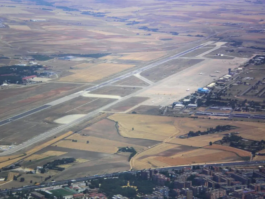
Restricted Airspace in Spain: How It Is Declared, Who Controls It and Why It Cannot Be Secret
There is no Spanish Area 51, and not out of goodwill: a closed zone that was never published would be unenforceable, unsustainable for air traffic control and visible in the diversions.
The Spanish regime of airspace limitation derives from the 1944 international civil aviation convention and the 1960 Ley de Navegación Aérea (Air Navigation Act). Prohibited, restricted and danger zones are published in the Spanish aeronautical information publication, with identifier, coordinates, vertical limits, activation schedules and responsible authority, and temporary reservations are announced through notices to air missions. An unpublished limitation would be legally unenforceable, would compromise civil traffic safety and would be visible in commercial air tracking records.
Executive summary of the case file. Everything essential before you dig deeper.
Fact sheet
OSINT - Traceability
People ask around here a lot whether a Spanish Area 51 exists. The short answer is no, and the long one is more interesting, because it does not depend on anyone’s goodwill: it depends on the fact that an airliner with a hundred and eighty people aboard needs to know where it cannot fly. Airspace closed in secret is no well-kept secret; it is a deathtrap waiting for its turn.
So this case file is about a procedure rather than a base, the least glamorous thing in the world and the one that settles the most questions. How Spain declares that a piece of territory is closed to flight, who decides it, where it is published and how anyone can check it from the couch.
I’m not here to prove anything, I’m here to put the smoke in order. And with this in hand, a considerable percentage of the sightings reported in this country can be resolved in one stroke.
What can be verified, first: publication is mandatory
The starting point dates from 1944 and lies in the convention that founded international civil aviation. Two ideas that belong together. The first: every state has complete and exclusive sovereignty over the airspace above its territory, so it can close whatever it sees fit. The second, which is the one that matters here: if it closes it, it has to say so, and say so in a way that lets any aircraft about to pass through find out in advance.
That obligation takes shape in a document that exists in every country in the world and that in Spain is published by the air navigation provider: the aeronautical information publication. It is a technical monster, freely accessible, laid out in numbered sections that are identical everywhere precisely so that a foreign pilot can find what he needs without knowing Spanish.
One of those sections, the one international rules number 5.1, is the list of zones with limitations. And everything is there, with a level of detail that surprises anyone who has never opened it: the identifier of each zone, its vertices in geographic coordinates, the floor and ceiling in feet or flight levels, the schedule or conditions under which it is active, the responsible authority and, often, the reason.
Zones fall into three classes and the distinction is not cosmetic. Prohibited: you do not enter, period. Restricted: you enter only if you meet certain conditions, normally prior coordination with whoever controls it. Danger: you may enter, but there may be activity inside that will ruin a pilot’s day, typically firing or launches. In international nomenclature, Spanish zones carry the prefix LE, which is the country indicator.
On top of that there is a second mechanism, for what is not permanent. When a piece of sky has to be closed temporarily (a military exercise, a forest fire with water bombers at work, an international summit, a State flight), a notice to air missions is issued. Those notices are also public and can be consulted with no registration at all: there are official lookup services open to anyone.
Why a secret zone cannot exist
And now the reasoning, which is simple and ironclad. If the State wanted to reserve airspace without publishing it, it would run into three problems at once, and all three are insurmountable.
The first is safety. A civilian aircraft flying its authorized route along a perfectly legal corridor would meet, in an unpublished sky, military activity that nobody had warned it about. That hypothesis is far from remote: it is how collisions and accidental shootdowns happen. No air traffic control in the world accepts that risk, because it is air traffic control that answers to a court afterward.
The second is accountability. In Spain, a limitation of rights (and banning flight over a property is one) is established by an administrative act, and an administrative act that is not published cannot be enforced against anyone. Without publication, no one who enters can be penalized, a controller cannot be required to divert traffic and the restriction cannot be defended before a court.
And the third is purely practical. Closing a sky without saying so forces traffic to be diverted without being able to explain why, with diversions that show up in the flight logs of any commercial air tracking service, the kind anyone now checks on a phone. The hole can be seen. Aviation enthusiasts have been detecting temporary reservations for years in exactly this way, by looking at where people stop flying.
The convention
The treaty founding international civil aviation enshrines the full sovereignty of the state over its airspace and the obligation to publish limitations.
The Spanish law
The Ley de Navegación Aérea (Air Navigation Act) sets the domestic framework: who may limit the use of airspace and by what procedure.
The publication
Prohibited, restricted and danger zones appear in the Spanish aeronautical information publication with coordinates, vertical limits, schedules and responsible authority.
Source ↗The notices
Activations and temporary reservations are announced through notices to air missions, also open to public consultation.
Declassification
The Ejército del Aire (Spanish Air Force) declassifies its sighting case files, which become available for consultation.
How to use this to verify a sighting
First, pin down the point
Coordinates of the observer and the approximate direction of the observation. Without that there is nothing to be done, and it is where most reports fail: “I saw it to the south” is not enough when to the south lie two hundred kilometers of territory.
Second, see whether it was inside a zone
With the point in hand, you check in the zones section whether that vertical falls inside an area with limitations and at what altitude. If it falls inside a firing zone or an exercise zone, there is already a working hypothesis that requires no additional assumption.
Third, check whether it was active that night
This is the decisive step and the one almost nobody takes. A restricted zone is activated by schedule or by notice, so it is not always active. Checking whether there was activity on that particular early morning turns a suspicion into a data point. And it works both ways: if the zone was closed, the sighting explains itself; if it was inactive, the case gains ground.
And fourth, look at the traffic
Commercial air tracking services keep a history. A luminous object moving slowly at high altitude usually has a registration, and checking takes two minutes. What does not appear there is informative too: military aircraft on exercises often fly without broadcasting their position, and that silence, crossed with an active zone, is in itself an indication.
Why this question won’t die
Because the answer is boring and is written in a format that scares people off. Opening the aeronautical information publication means opening a technical document full of abbreviations, imperial units and coordinates in degrees, minutes and seconds. Next to that, “there’s a secret base in Los Monegros” is a sentence you say at the bar and understand at once.
And because the system, though public, was designed for pilots: it is published where pilots look. A resident of a town with maneuvers overhead receives no notice: the information exists, it is theirs and within their reach, but nobody puts it in front of them. That gap between what is published and what is communicated is the ground where all the mythology grows.
There is also a common confusion worth clearing up. That a military installation has restricted-access zones on the ground (and it does, with good reason) does not mean a regime of secrecy exists over its airspace. They are two different things, with two different sets of rules. Entry to a barracks can be forbidden without that affecting the publication of whatever aerial limitation lies above it.
This is seen very clearly at the Bardenas range, the most cited Spanish case: a real restricted zone, real activity, real sightings in the region… and all the information published for decades. It is also seen in the declassification of the Ejército del Aire case files, where some of the cases were resolved, precisely, by crossing the date with the military activity of that night.
The other Spanish records almost nobody uses
Since we are on the subject of boring and effective sources, the others should be set down here, because in Spain there are quite a few more than people use, and all of them are free.
The first is weather balloons. The meteorological service launches radiosondes twice a day, at fixed hours, from a handful of stations around the country. One of those balloons climbs tens of kilometers, expands until it is several meters across and, when the sun catches it at altitude while it is already night below, becomes a bright luminous point that drifts slowly and silently. It is one of the classic sources of sightings, and its schedule is public and predictable.
The second is satellite constellations in formation. In recent years, launches of dozens of satellites deployed in a line produce the phenomenon of the light train: a row of equidistant points crossing the sky in silence, which in the days after a launch generates waves of phone calls across the country. There are public services that predict the passes to the second.
The third is the declassified archive of the Ejército del Aire. Between 1992 and 1999 the sighting case files held by the service were opened, and that collection can be consulted. It is a source of incalculable value and remarkably little used: it contains radar reports, statements from military pilots and official conclusions on Spanish cases that are still argued over on the internet as if no paper existed.
And the fourth is the most obvious and the most forgotten: the astronomical ephemeris. Venus at greatest elongation, near the horizon and with atmospheric turbulence, produces a very bright object that flickers in colors and seems to move. It is, year after year, the leading cause of reports in any country that keeps statistics. Checking where Venus was that night takes thirty seconds.
With those four sources, plus the aeronautical publication and the traffic history, the vast majority of what arrives in a mailbox like ours is resolved. And what survives the six checks is, truly, a case file worth opening. That is the work: not disbelieving, but ruling out in order.
Spanish secrecy does not live in a desert hangar. It lives in a freely accessible technical document, written in a jargon that guarantees nobody opens it. It is a far more effective form of opacity and a good deal less cinematic.
OSINT – Source traceability
Specific zone identifiers and their coordinates are not reproduced: they change with editions of the aeronautical publication, and citing them would give false and perishable precision. Readers are referred to the live document. The number of the zones section is given according to the standardized international structure.